We’ve got more details on North Korea’s plans to launch a rocket later in December, including the daily launch window and where parts of the rocket might drop to sea. [Updated: See below]
 The details were included in a notification sent from the DPRK’s embassy in London to the International Maritime Organization (IMO), which is based in the same city.
The notification, a copy of which was obtained by NorthKoreaTech.org, says the rocket will launch sometime between 7am and noon local time (2200 to 0300 GMT) during the possible launch period, which is from December 10th to 22nd.
North Korea’s previous rocket launch, which ended in failure in April, was also scheduled to launch during the same daily window. It eventually blasted off at 7:39am local time, according to reports.
Just as last time, the letter has been sent in the name of Ko Nung Du, who is identified as director general of the DPRK’s Maritime Administration.
It’s almost identical word-for-word with that sent earlier this year.
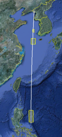
As before, it notifies of areas where it believes the rocket’s first and second stages will fall into the ocean should the launch is successful.
An addition this time is an area where the satellite fairing, the protective cover that surrounds the satellite during the first stage of launch, is expected to fall back to sea.
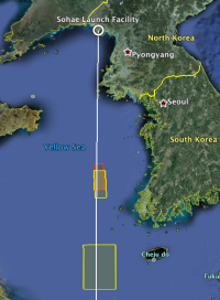
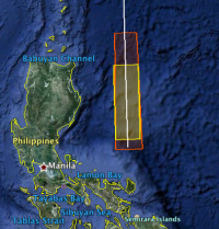
Comparing the areas notified last time and this time, changes can be seen.
The first-stage drop zone is a little further to the south and east that April’s launch while the second-stage drop zone is more tightly defined.
Here’s a couple of close-ups of the first- and second-stage drop zones. The April launch zones are in orange and the December zones in yellow. (click on the images to make them larger)
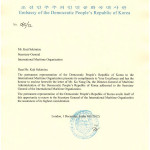
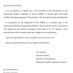
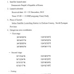
Here’s a copy of the letter from the DPRK embassy in the U.K. to the IMO.
UPDATE:
I’ve just received the text of the notice the DPRK has issued to pilots. The “notice to airmen,” usually abbreviated to NOTAM, contains the same information as the communique to the IMO.
A0108/12 (Issued for ZKKP PART 1 OF 2) - DETAILED INFORMATIONS ON THE LAUNCH OF SATELLITE ?KWANGMYONGSONG
-3?(2)
ARE AS FOLLOW:
1. SATELLITE LAUNCH STATE:
 DEMOCRATIC PEOPLE'S REPUBLIC OF KOREA
2. LAUNCH SCHEDULE:
 RESERVED DATE: 09-22 DECEMBER 2012
 TIME: 2200-NEXT 0300(UTC) DAILY
3. PLACE OF LAUNCH:
SOHAE SATELLITE LAUNCHING STATION IN CHOLSAN COUNTY, NORTH PYONGAN
 PROVINCE
//PART 01 OF 02//. DAILY 2200-NEXT 0300, 09 DEC 22:00 2012 UNTIL 22 DEC 03:00
2012. CREATED: 01 DEC 08:05 2012
A0108/12 (Issued for ZKKP PART 2 OF 2) - 4. DANGEROUS AREA COORDINATES:
 FIRST STAGE
354406N 1243030E
354407N 1245423E
345836N 1243232E
345843N 1245611E
 SECOND STAGE
181344N 1234837E
181254N 1244520E
153107N 1234624E
153017N 1244219E
 FAIRING
334006N 1240747E
333951N 1251229E
322422N 1240750E
322407N 1251137E. GND - UNL //PART 02 OF 02//, DAILY 2200-NEXT 0300, 09 DEC
22:00 2012 UNTIL 22 DEC 03:00 2012. CREATED: 01 DEC 08:05 2012

